Our Services
Wetland Assessment Impact Report (WAIR)

Biophysical Impact Assessment (BIA)
Rare Plants and Rare Plant Communities Surveys
Migratory Bird Nest Sweeps Inclusive Wildlife Sweeps
Habitat Restoration and Revegetation Plans
Vertebrate Species at Risk Surveys
Weed
surveys
GIS and Remote Sensing Habitat Mapping
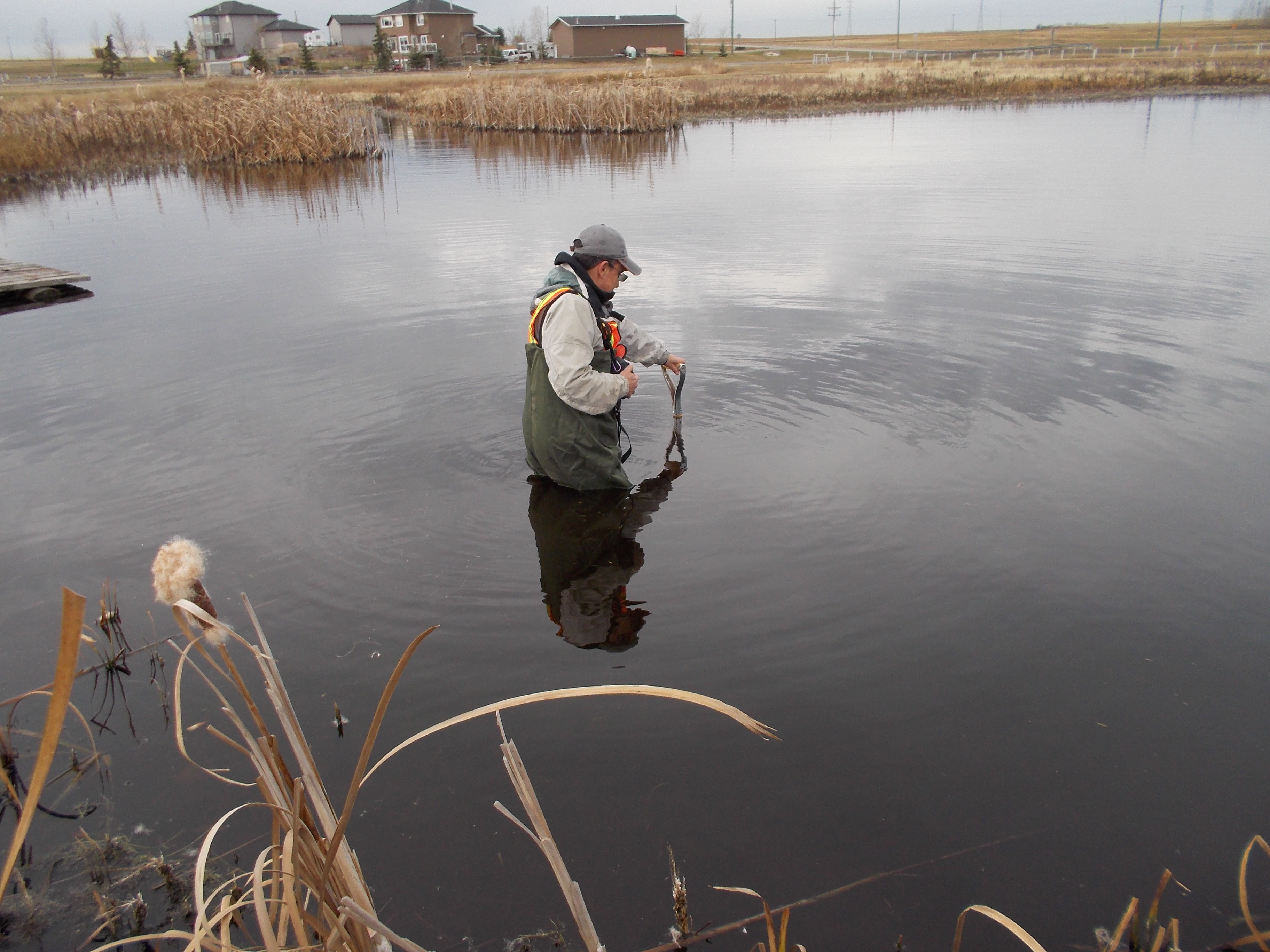
Wetland Assessment Impact Report (WAIR)
Wetlands play an important role in the landscape providing habitat for a wide diversity of plants and animals, including rare plants and wildlife Species at Risk. All waterbodies in Alberta are owned by the province, regardless of whether they occur on public or private land. Activities impacting wetlands are regulated under the Water Act. An approval under the Water Act is required when wetlands are disturbed or lost due to a proposed development.
ECOTONE’s wetland group includes experienced Qualified Wetland Science Practitioners (QWSPs) who routinely complete Wetland Assessment and Impact Reports (WAIRs), Wetland Assessment and Impact Forms (WAIFs), and Code of Practice forms following the most up to date regulations and guidelines released by Alberta Environment and Parks. WAIRs are the main technical reports required to apply for an approval under the Water Act.
ECOTONE has expertise in wetland classification, boundary delineation, functional assessment, impact assessment, restoration, and compensation design. We often work closely with hydrologists, hydrogeologists and engineers to design stormwater wetlands.
Biophysical Impact Assessment (BIA)
ECOTONE specializes in completing Preliminary Natural Site Assessments (PNSAs), Environmental Screenings (ESs), and Scoped Biophysical Impact Assessments (BIAs). Disciplines that we cover include: wetlands, wildlife/Species at Risk, wildlife habitat, vegetation/rare plants/weeds, soils, and biodiversity. BIA tasks for the above disciplines include:
- Scoping and issues analysis;
- Identification of impacts;
- Focused baseline inventory and analysis;
- Mitigation measure design;
- Determination of significance;
- Information Request responses.
ECOTONE often applies empirical data collection and scientific studies for project-specific BIAs in order to provide clients with the most confident impact predictions possible. We focus on the main issues and work with regulators to focus and trim project Terms of References.
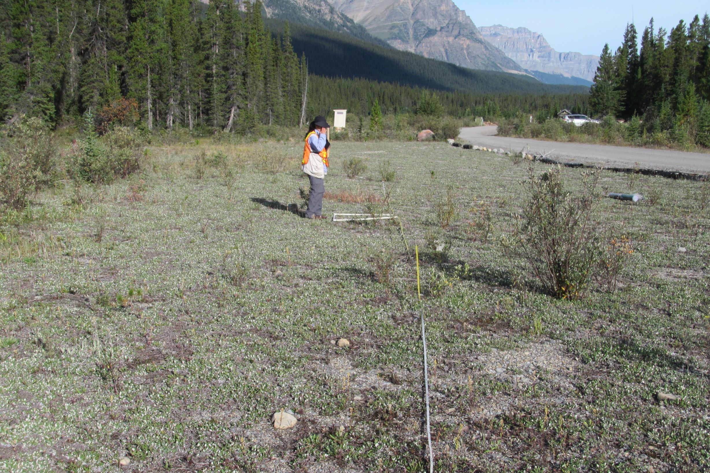
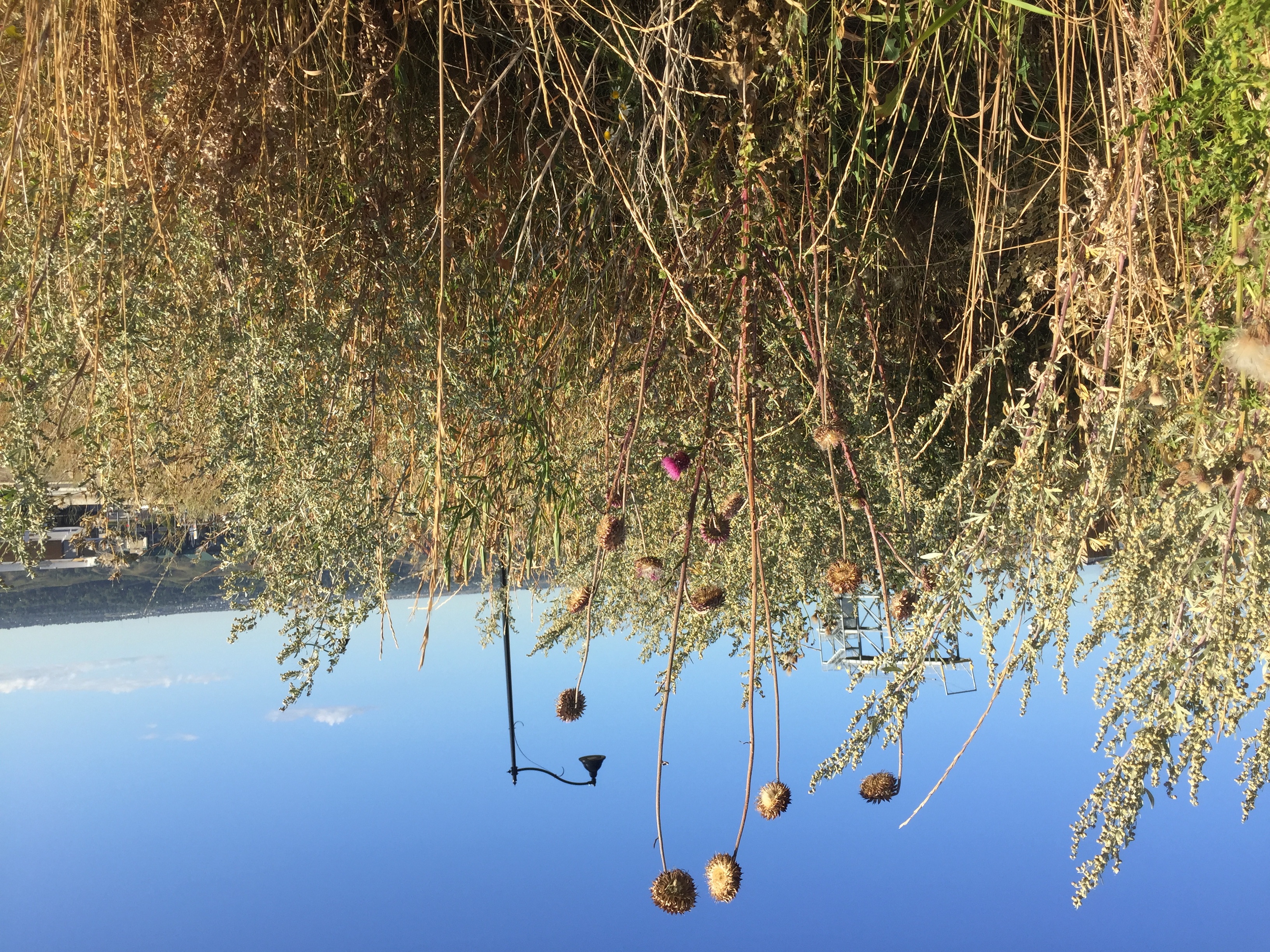
Rare Plants and Rare Plant Communities Surveys
Alberta Conservation Information Management System (ACIMS) ranks plant species and plant communities according to their known abundance in each ecological region of Alberta. Plant species ranked S1 (Known from five or fewer occurrences, or especially vulnerable to extirpation because of other factor(s), S2 (Known from twenty or fewer occurrences, or vulnerable to extirpation because of other factors), and S3 (Known from 100 or fewer occurrences, or somewhat vulnerable due to other factors, such as restricted range, relatively small population sizes, or other factors) are considered to be rare or uncommon.
ECOTONE’s team includes experienced taxonomic botanists that have completed several rare plants and rare plant communities surveys. To ensure an effective and scientific survey of the area we follow Guidelines for Rare Plant Surveys proposed by the Alberta Native Plant Council. This includes walking slowly through the site and performing a hands and knees survey at selected sites that offers adequate microhabitat for the establishment of rare species. If a rare species is detected several data sources are collected including: exact location with the help of a global position system (GPS); plant community where the species is located; approximate number of rare plants growing at the site; and, land area (m2) occupied by the population.
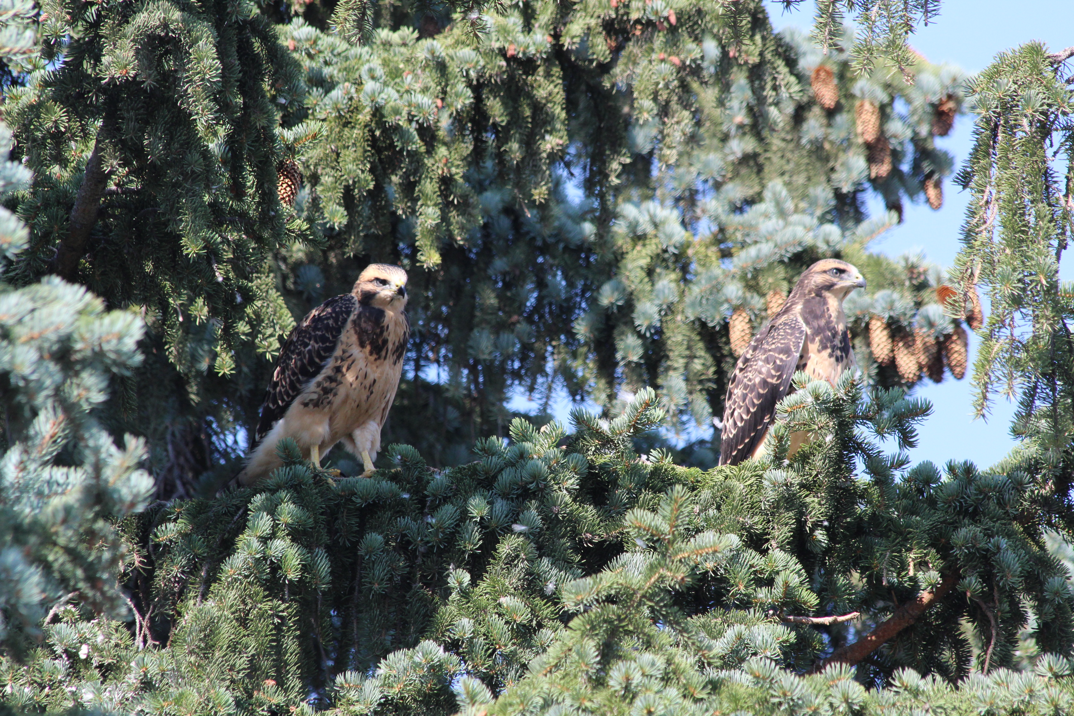
Migratory Bird Nest Sweeps and Inclusive Wildlife Sweeps
The Migratory Birds Convention Act is administered by the Canada Wildlife Service. It provides for the protection of migratory birds, their nests, and their eggs through the Migratory Birds Regulations and the Migratory Birds Sanctuary Regulations. It mainly applies in the early stages of a development, previous and during the clearing and stripping of the site when avoidance of migratory birds and their nests is required.
Inclusive Wildlife Sweeps target migratory bird nests, raptor nests, active mammal dens, and snake hibernacula. Studies are undertaken to align with the Migratory Birds Convention Act, the Alberta Wildlife Act and federal Species at Risk Act. The reports describe methods and results of field surveys and provide any necessary recommendations for regulatory compliance and environmental protection.
ECOTONE’s professionals routinely complete migratory bird nest sweeps and inclusive wildlife sweeps to ensure our clients are compliant with the Migratory Birds Convention Act, the Alberta Wildlife Act and federal Species at Risk Act.
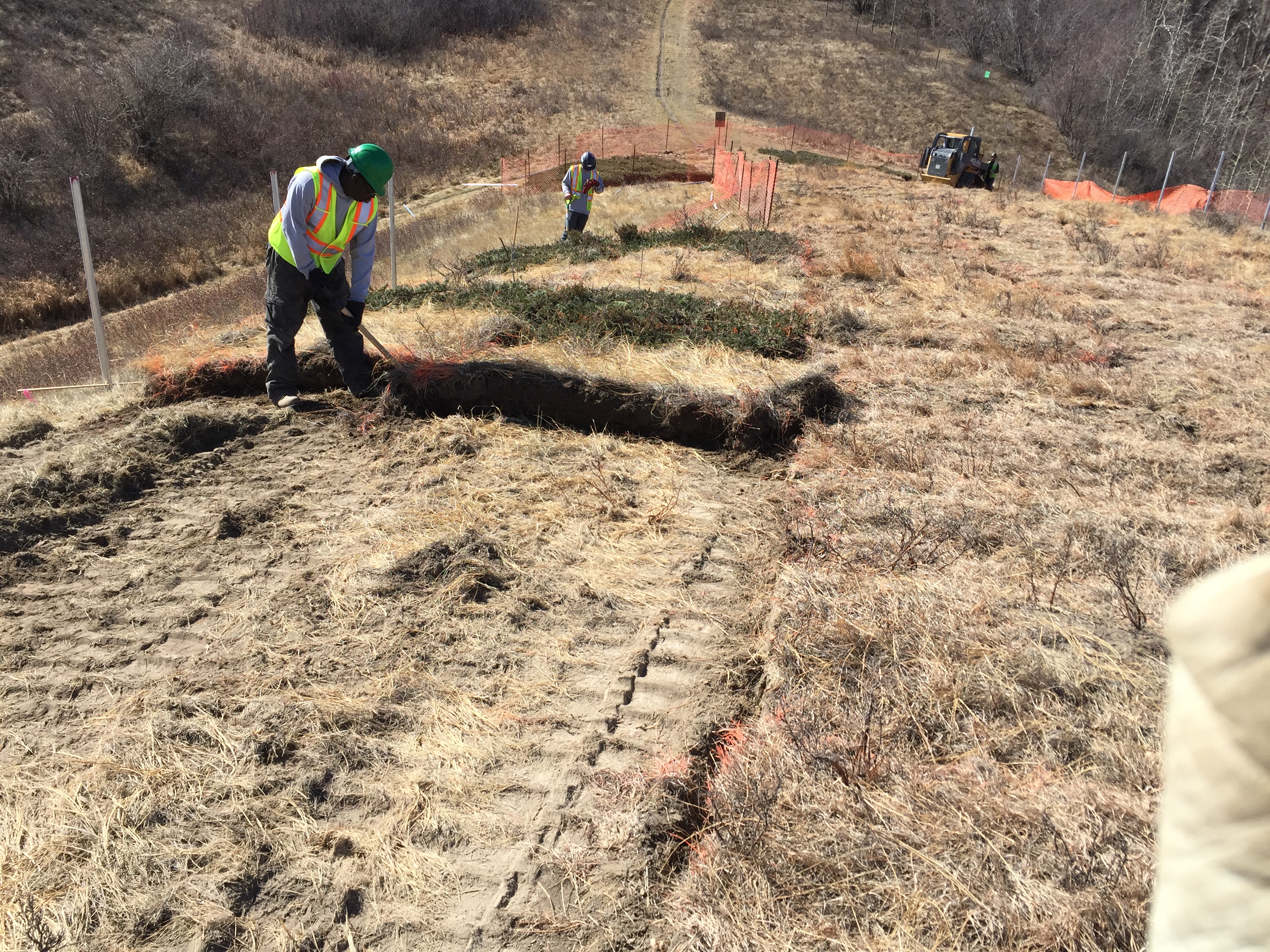
Habitat Restoration and Revegetation Plans
The goal of every ecological restoration project is “to re-establish a functional ecosystem of a designated type that is self-sustaining, has sufficient biodiversity to continue its maturation by natural processes and to evolve over longer time spans in response to changing environmental conditions” (Society for Ecological Restoration (20002).
Design and multi-year monitoring of Habitat Restoration and Revegetation Plans have been one of the primary specialties of ECOTONE with several restoration projects for riparian bank stabilization, natural wetlands and naturalized stormwater/wetlands restoration and revegetation, and native prairie restoration.
ECOTONE has successfully designed restoration plans including: sod transplanting of rare plant communities, plug transplanting of rare plants, native seed grass and forb mixes tailored to the specific project conditions, and low and tall shrub species design to fix nitrogen and provide habitat and cover for specific wildlife species.
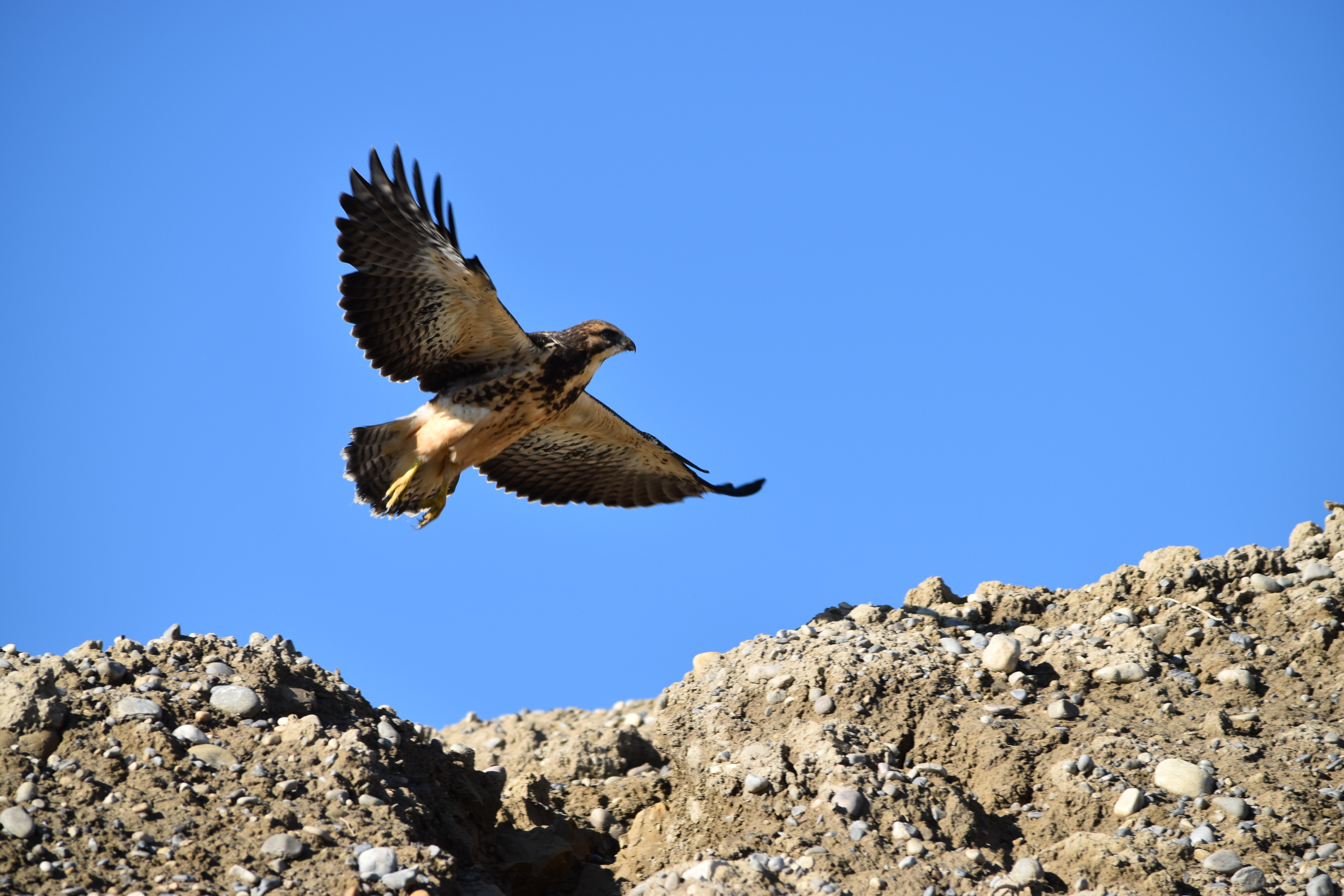
Vertebrate Species at Risk Surveys
Wildlife Species at Risk are protected federally and provincially under the Species at Risk Act (SARA) and the Wildlife Act, respectively. Detection of any of these species is fundamental before clearing and stripping activities take place.
ECOTONE follows the Government of Alberta’s Sensitive Species Inventory Guidelines to ensure the quality and reliability of each survey. Our biologists have experience performing:
- Breeding Song Bird surveys;
- Waterfowl surveys;
- Raptor surveys;
- Amphibian surveys;
- Reptile surveys;
- Mammal Surveys;
- Bat surveys.
If endangered or threatened species are found within a proposed development property, ECOTONE will design mitigation measures to avoid impacts on those species and comply with federal and provincial regulations.
Weed surveys
The Alberta Weed Control Act aims to regulate noxious weeds, prohibited noxious weeds, and weed seeds through various control measures, such as inspection and enforcement, together with provisions for recovery of expenses in cases of non-compliance. If prohibited noxious weeds are found they must be eradicated and if noxious weeds are found they need to be controlled.
ECOTONE professionals are skilled in the identification of noxious and prohibited noxious weed species at different stages of growth development, as well as the design of Weed Management Plans. We work closely with Project planners and engineers to implement weed identification and eradication programs
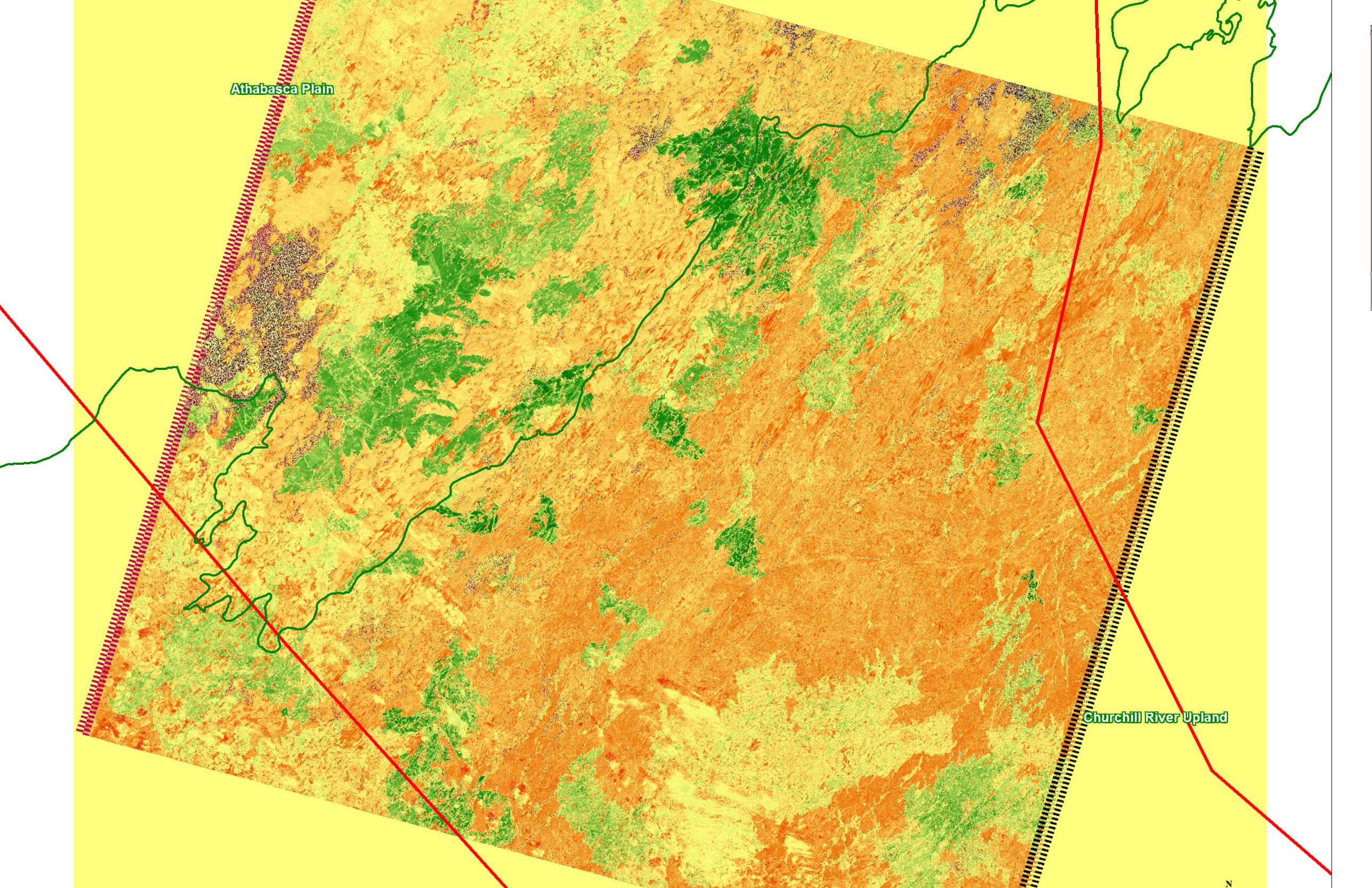
GIS and Remote Sensing Habitat Mapping
ECOTONE routinely applies GIS mapping and analysis to ecological land use projects. Multi-scale habitat mapping provides the framework for assessing local and regional impacts. Habitat and wetland mapping is one of ECOTONE’s core specialities using air-photos and/or satellite imagery (IKONOS, SPOT, LANDSAT).
ECOTONE has use time series (i.e. multi-date satellite images covering a targeted area) to detect habitat changes through time, map residual key habitat patches after fire events, and monitor restoration success. Formal accuracy assessments are completed for all mapping projects.